
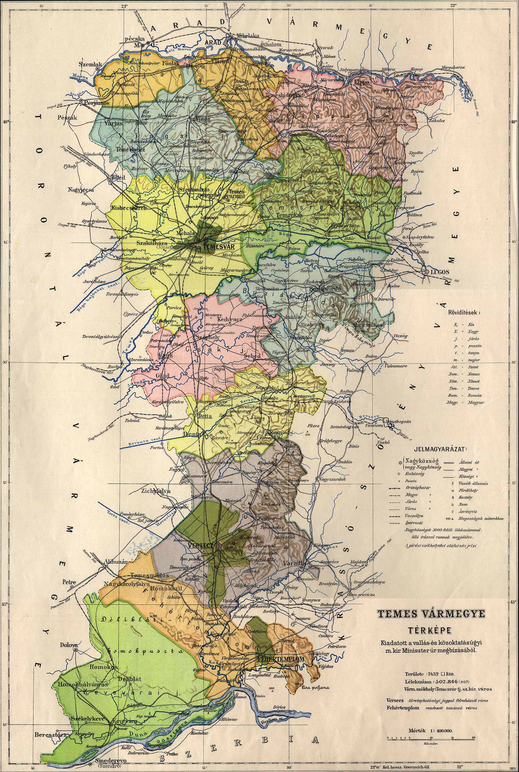
Here are several links to useful maps of eastern Europe.
Initially this page contained some links to online mapping sites that would locate our villages. However, we found that these links did not stand up over time. We suggest that you use the mapping features of providers such as Google, Bing, or Mapquest. Some sites even allow you to access satellite or other aerial views. We have found that some of the lesser known sites do not have good detail on eastern Europe. Also, a word of caution: We have seen cases where the mapping symbol marking the village is not correct, so do some homework to be sure that you are looking at the right place. Note also that you will need to search for the current name, not the old German name.
History of Eastern Europe in maps
MapQuest map of Plandiste, Serbia
Historical maps of Austria-Hungary